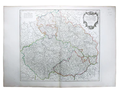
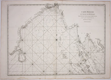
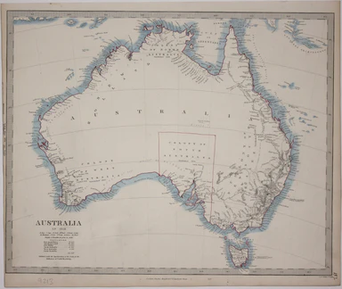
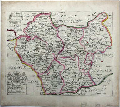
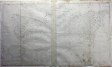
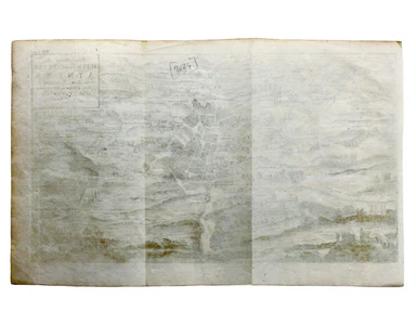
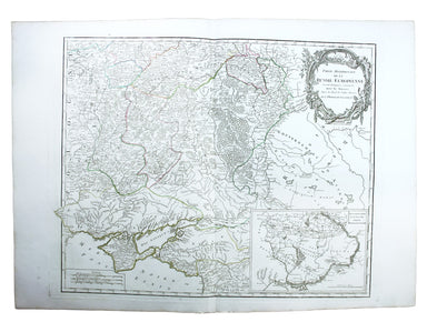
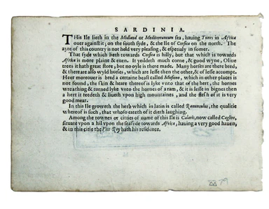
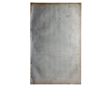
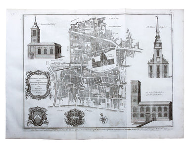
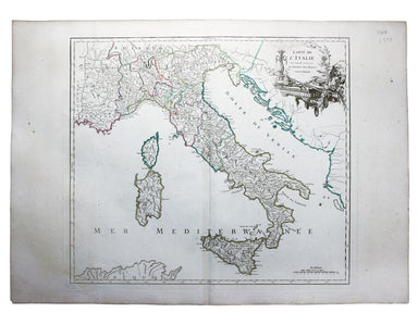
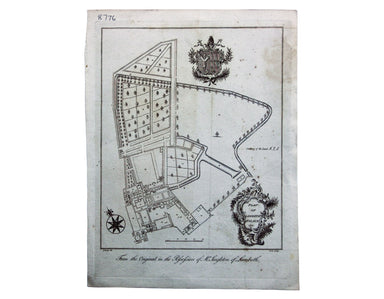
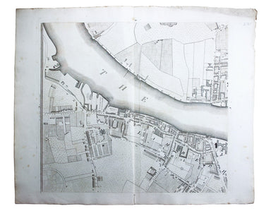
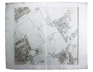
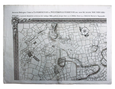
Mannevillette’s Chart of the Bay of Bengal
Carte Reduite du Golfe de Bangale D’Après de Mannevillette (1707-1780) was a practical seaman as well as a mapmaker; his sea atlas was published in...
View full detailsCarte Reduite du Golfe de Bangale D’Après de Mannevillette (1707-1780) was a practical seaman as well as a mapmaker; his sea atlas was published in...
View full detailsCarte reduite des Isles de Jersey Grenesey et d'Aurigny avec les Costes de Normandie et de Bretagne qui en sont voisines This chart covers the Chan...
View full detailsBlome published the first new series of county maps in the sixty years since the appearance of John Speed’s ‘Theatre’. In the straightened financia...
View full detailsAt the foot of this map are architectural elevations of some of Rome’s most famous post-classical buildings, dominated by St Peter’s. Rome was then...
View full detailsThis map of Australia has a table in the bottom left, showing the European population (supposedly revised to 1846 but with the original figure give...
View full detailsThe Central London Railway produced a considerable quantity of advertising material in the Edwardian period. Other postcards included views of Lots...
View full detailsMetropolitan Goods Conference Map of Collection & Delivery Boundary This map is a variant of the London plan typically issued with Kelly’s Dire...
View full detailsAn accurate map of the County of Worcester divided into its hundreds and drawn from the best authorities. Illustrated with historical extracts rela...
View full detailsBritish Empire Throughout the World Exhibited in One View This is a highly decorative map of the British Empire by John Bartholemew, with British p...
View full detailsSurvey of the country around London to the distance of thirty two miles from St Paul’s The map extends between Ware and Chatham, Bray and Dorking. ...
View full detailsDistrict within ¼ mile radius [of] Manor House Stanford’s was a firm of map publishers as well as map retailers until after the Second World War, w...
View full detailsGarbutt believed he had ‘rescued’ the London Underground map from the clutches of Harold Hutchison and his ‘ham-fisted parody’ of Beck’s designs. H...
View full detailsMap of London with John Rennie’s Waterloo and Southwark Bridges (opened 1817 and 1819) shown First published in 1818, the scale, top left on our ex...
View full detailsRobert Morden's maps were engraved to illustrate Gibson's edition of William Camden's Britannia, first published in 1695 and reprinted in various 1...
View full detailsThis is an LNER colliery map covering the midlands and north of England and Wales ('Collieries in Yorkshire, Nottinghamshire, Derbyshire, Lancashir...
View full detailsBlome published the first new series of county maps in the sixty years since the appearance of John Speed’s ‘Theatre’. In the straightened financia...
View full detailsWilliam Camden was an Elizabethan historian who wrote a county by county description of England. He continued to revise and expand his work, which ...
View full detailsRobert Morden's maps were engraved to illustrate Gibson's edition of William Camden's Britannia, first published in 1695 and reprinted in various 1...
View full detailsVorstellung des Alten und Neven Athens, von dem Venetiani – schen Geographo Herrn Pat. Coronelli verzeichnet Coronelli’s plan retains features of t...
View full detailsThe United Nations was established in October 1945, and Bullock’s map is a joyful celebration of what promised to be a more effective successor to ...
View full detailsLord Nelson explaining to the Officers the Plan of Attack previous to the Battle of Trafalgar… Position of the Combined Forces of France & Spai...
View full detailsPartie Méridionale de la Russie Européenne This is a late state of Robert de Vaugondy’s map of southern Russia, Ukraine and parts of Poland. The or...
View full detailsThis is a map of the Maluku Islands, part of the mountainous, volcanic archipelago known to Europeans as the spice islands. The islands were the fo...
View full detailsTwo English printers dipped a toe in the vernacular atlas market at approximately the same time with pocket editions of the Ortelius atlas: ‘These ...
View full detailsDistrict within ¼ mile radius [of] Uxbridge Stanford’s was a firm of map publishers as well as map retailers until after the Second World War, with...
View full detailsLower Egypt and the Adjacent Deserts with a part of Palestine; to which has been added the Nomenclature of the Roman Age… This map of of Egypt and ...
View full detailsThe guide seems to have been aimed at an American audience, with several pages devoted to converting prices in pounds, shillings and pence into dol...
View full detailsThis Central London Railway map is similar in style to the UERL common design which had been in circulation since 1908, although with a chocolate r...
View full detailsBenjamin Getzel Lewis' map of the London underground shows the Victoria Line under construction in the originally proposed colour Lewis (1900-1966)...
View full detailsThe Evening News was responsible for coining the name ‘Bakerloo Line’ for the Baker Street and Waterloo Railway, and here the newspaper makes a rel...
View full detailsTower Street Ward with their [sic] divisions into Parishes according to a new survey This plan of Tower Street was published in the greatly expande...
View full detailsCheap Ward with its divisions into Parishes according to a new survey This ward plan of Cheap was published in the greatly expanded second edition ...
View full detailsBaynard’s Castle Ward [and] Faringdon Ward with their divisions into Parishes according to a new survey This was plan of Baynard’s Castle and Farin...
View full detailsCarte de l’Italie, dans laquelle sont tracées les Routes des Postes This is a later state of Robert de Vaugondy’s road map of Italy, showing the Ve...
View full detailsLe Royaume de Boheme, le Duche de Silesie, et les Marquisats de Moravie et Lusace, dressés d’apres les cartes de Muller The second state of Robert ...
View full detailsLe Royaume de Hongrie, Principaute de Transilvanie, Sclavonie, Croatie, et partie de la Principaute de Valaquie, de la Bosnie, de la Servie et de l...
View full detailsArchipel des Indes Orientales, qui comprend les Isles de la Sonde, Moluques et Philippines, tirées des Cartes du Neptune Oriental This map of Indon...
View full detailsL’Empire de la Chine dressé d’apres les Cartes de l’Atlas Chinois This detailed and relatively accurate map of China, Korea and Taiwan was derived ...
View full detailsLa Bataille de Lens en Flandre gaignee par l’Armee du tres Chres[tien] Louys XIIII Roy de France ed de Navarre, Comandee par Monseigneur le Prince ...
View full detailsPlan of Lambeth Palace 1750… from the original in the possession of Mr Singleton of Lambeth This plan of Lambeth Palace published in Ducarels’s ‘Th...
View full detailsSheet C4 from Horwood’s ‘Plan of the Cities of London and Westminster…’ Horwood’s plan is a landmark in London mapping on a number of counts. It wa...
View full detailsSheet C1 from Horwood’s ‘Plan of the Cities of London and Westminster…’ Horwood’s plan is a landmark in London mapping on a number of counts. It wa...
View full detailsEnvirons of Wembley from Rocque’s ‘An Exact Survey of the City’s of London, Westminster, ye Borough of Southwark and the Country Near Ten Miles Rou...
View full detailsThis is a view showing London before the Great Fire, from the South Bank of the Thames, including London Bridge and old St Paul’s. Principal buildi...
View full detailsThis map of South Africa, including an inset of Cape Town, was engraved by John & Charles Walker. It was published by the SDUK. The Society for...
View full detailsThese maps of Staffordshire and Shropshire are presented on one sheet. Unlike Kip and Hole, Speed and Blaeu – who all devoted an entire map-sheet t...
View full detailsGerman Dominions of the King of Great Britain; Comprized under the name of Electorate of Brunswick-Luneburg and including the Dutchies of Bremen, V...
View full details