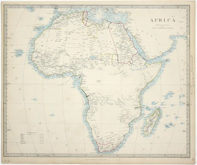
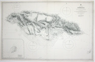
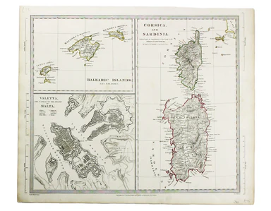
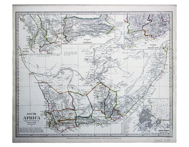
SDUK Map of Africa
This map of Africa reflects the state of European knowledge of the interior before the mid 19th century search for the sources of the Nile. It mark...
View full detailsThis map of Africa reflects the state of European knowledge of the interior before the mid 19th century search for the sources of the Nile. It mark...
View full detailsThis chart of Jamaica shows soundings etc, with interior detail of relief, roads and settlements, and an inset of Morant Cays. First published in 1...
View full detailsWest Indies – Santa Cruz [Saint Croix] This chart of Saint Croix shows soundings etc, with interior detail of relief, roads and settlements, coasta...
View full detailsThis map of County Durham was engraved by J & C Walker after Creighton for Lewis’ Topographical Dictionary. Condition & Materials Steel eng...
View full detailsThis map of France was engraved by J & C Walker after T Hewett Key. Condition & Materials Steel engraving, approx 33 x 35 cm, original hand...
View full detailsThis map of the Balearics, Corsica, Sardinia and Valetta was published by the SDUK The Society for the Diffusion of Useful Knowledge was founded in...
View full detailsAt the foot of this map are architectural elevations of some of Rome’s most famous post-classical buildings, dominated by St Peter’s. Rome was then...
View full detailsThis map of Australia has a table in the bottom left, showing the European population (supposedly revised to 1846 but with the original figure give...
View full detailsThis map of South Africa, including an inset of Cape Town, was engraved by John & Charles Walker. It was published by the SDUK. The Society for...
View full detailsChart of the South East Coast of Arabia from Ras Sukra to Palinurus Shoal, compiled from trigonometric Surveys First published in 1860 with correct...
View full details