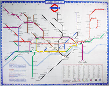
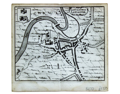
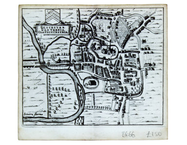
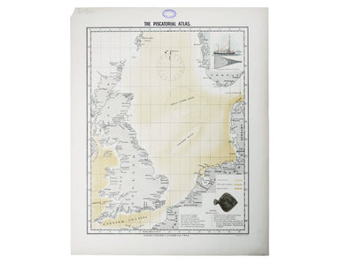
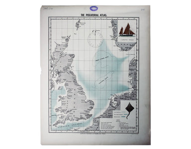
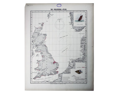
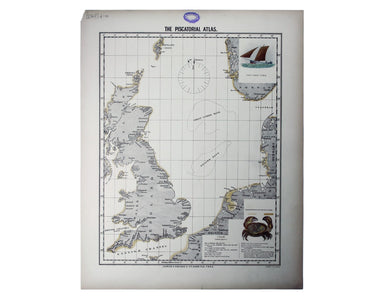
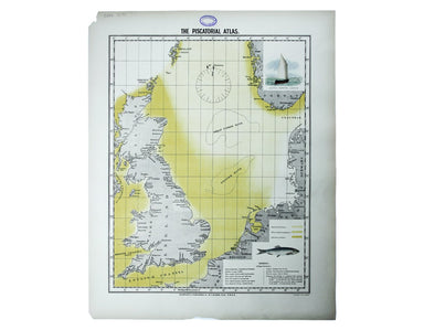
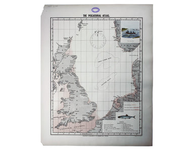
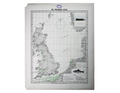
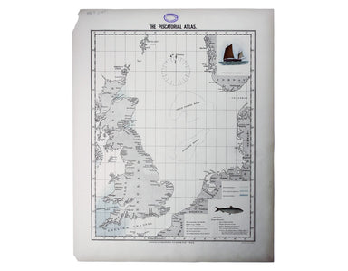
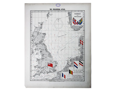
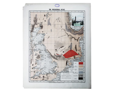
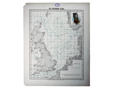
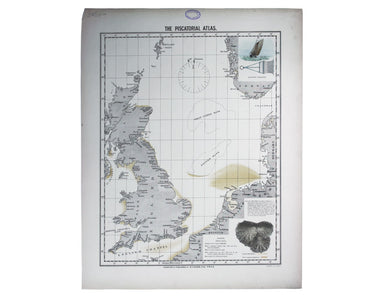
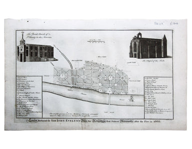
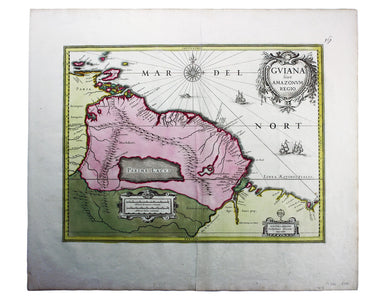
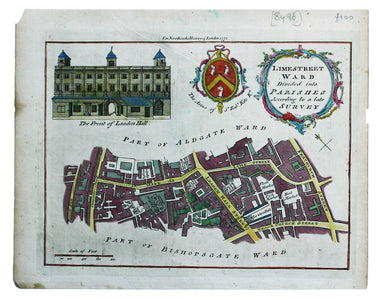
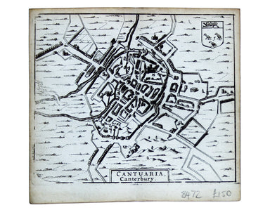
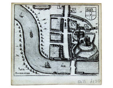
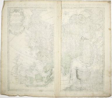
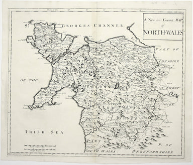
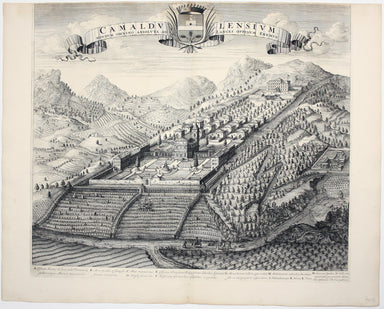
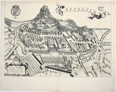
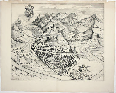
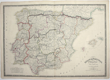
Olsen’s Chart of Turbot Stocks in British Waters
The fish with a face only a mother could love This map was published in the ‘Piscatorial Atlas of the North Sea, English and George’s Channels’, a ...
View full detailsThe fish with a face only a mother could love This map was published in the ‘Piscatorial Atlas of the North Sea, English and George’s Channels’, a ...
View full detailsMeunière your skate wings, or get someone else to do it for you This map was published in the ‘Piscatorial Atlas of the North Sea, English and Geor...
View full detailsWhy is it proverbially assumed to be very easy to run a whelk stall? They look like hard work to me This map was published in the ‘Piscatorial Atla...
View full detailsFor a rainy day supper, put crab in your macaroni cheese. Trust me, you’ll love it This map was published in the ‘Piscatorial Atlas of the North Se...
View full detailsThey’re bonnie fish and halesome farin’ This map was published in the ‘Piscatorial Atlas of the North Sea, English and George’s Channels’, a series...
View full detailsTry Scotch Woodock, per The Ritz London Book of Afternoon Tea. For a pared-down version, simply spread hot buttered toast with Gentleman’s Relish a...
View full detailsWaiter, bring me shad roe... This map was published in the ‘Piscatorial Atlas of the North Sea, English and George’s Channels’, a series of 50 lavi...
View full detailsPilchards are either sardines, herring, or neither. I think it depends where you (and they) are from. This map was published in the ‘Piscatorial At...
View full detailsThe Piscatorial Atlas was the product of a decade or more of reports and correspondence with British fishermen This map was published in the ‘Pisca...
View full detailsThis map was published in the ‘Piscatorial Atlas of the North Sea, English and George’s Channels’, a series of 50 lavishly chromolithographed chart...
View full detailsSee the east coast Fishwife with her creel This map was published in the ‘Piscatorial Atlas of the North Sea, English and George’s Channels’, a ser...
View full detailsO Oysters, come and walk with us! This map was published in the ‘Piscatorial Atlas of the North Sea, English and George’s Channels’, a series of 50...
View full detailsLondon Restored or Sir John Evelyn’s Plan for Rebuilding the Antient Metropolis after the Fire in 1666 Evelyn, Wren and Hooke were among the archit...
View full detailsThibet, Mongolia, and Mandchouria This map was engraved by John Rapkin for the ‘Illustrated Atlas’; with vignettes including Leh in Ladakh, a stret...
View full detailsVoyage en ballon dirigeable a travers l’Europe No rule sheet, but fairly self explanatory: the board is a simplified map of Europe with vignettes o...
View full detailsL’Italie qui comprend les Etats de Piémont, les Duchés de Milan, de Parme, de Modene, de Mantoue etc., les Républiques de Genes, de Venise, de Luqu...
View full detailsThe critics have not been kind to Harold Hutchison, and nor have we. His design, which replaced Beck’s diagram, was unveiled to the public – and to...
View full detailsHarold Hutchison believed that he could design a superior version of the Beck diagram himself. He was wrong. With a print code dated January 1960, ...
View full detailsThis plan of Glasgow was published in Bacon’s ‘New Large Scale Ordnance Atlas of the British Isles’. Condition & Materials Lithographed town p...
View full detailsThis is a late issue of Blaeu’s map of Guiana, with full-body colour typical of the later seventeenth-century. Seventeenth and eighteenth century m...
View full detailsCarte de la Coste d’Arabie, Mer Rouge, et Golfe de Perse. A map of the Arabian peninsula. Jacques Nicolas Bellin the elder (1703-1772) was first ch...
View full detailsLimestreet Ward divided into Parishes according to a late Survey Possibly engraved by Thomas Bowen and first published in the London Magazine, this...
View full detailsCheap Ward with its Divisions into Parishes according to a New Survey This ward plan of Cheap was published in the greatly expanded second edition ...
View full detailsThe Parish of St Johns Wapping; The Parish of St. Paul Shadwell This detailed ward plan of Wapping and Shadwell includes Execution Dock, where sent...
View full detailsTown Plan of Wien (Vienna) – Second Edition –- Sheet 5 (Central) The Prater Park with its famous giant wheel is a fraction to the east of the city ...
View full detailsLes Indes Orientales This is Santini’s edition of Robert de Vaugondy’s map of the Indian subcontinent and mainland southeast Asia. Venetian map-mak...
View full detailsThis map of the Bay of Bengal is from the first edition of Tabularum geographicarum contractarum libri, a geographical work which is normally catal...
View full detailsThis map of Southern India and Sri Lanka on an east-west alignment is from the French text edition of Tabularum geographicarum contractarum libri, ...
View full detailsBurma – Gulf of Mataban – Rangoon River and Approaches This chart covers the mouth of the river between Rangoon (Yangon) and the sea. It shows vill...
View full detailsDistrict within ¼ mile radius [of] Monument Stanford’s was a firm of map publishers as well as map retailers until after the Second World War, with...
View full detailsThis map of Canterbury is from Hermannides' Magna Britannia. Nearly all of the plans are based on the small inset plans shown on John Speed's count...
View full detailsThis map of Rochester is from Hermannides' Magna Britannia. Nearly all of the plans are based on the small inset plans shown on John Speed's county...
View full detailsThis map of Lancaster is from Hermannides' Magna Britannia. Nearly all of the plans are based on the small inset plans shown on John Speed's county...
View full detailsThis map of Gloucester is from Hermannides' Magna Britannia. Nearly all of the plans are based on the small inset plans shown on John Speed's count...
View full detailsThe first part of this work details the construction of semi-permanent bridges at Arnhem, Xanten, Rees and Spyck. The second part covers the equall...
View full detailsJohn Thomson's maps, like this one of the Channel, are characteristic of the Edinburgh school of cartography. It flourished at the beginning of the...
View full detailsThis educational handkerchief (why not?) is in the same format as the series of thirteen 'mouchoirs militaire d'instructions' patented by the comma...
View full detailsThis wartime souvenir handkerchief map of Europe was issued ‘by permission of the Manchester Guardian’, who printed the map over a full broadsheet ...
View full detailsThis map of the continent of Asia was prepared for the Homann firm by Johann Matthias Hase, professor of mathematics in Wittemberg, on his stereogr...
View full detailsThis map of Africa reflects the state of European knowledge of the interior before the mid 19th century search for the sources of the Nile. It mark...
View full detailsThis map of Antwerp, engraved by Benjamin Rees Davies after William Barnard Clarke, includes elevations of principal buildings and a view of the ci...
View full detailsA New and Correct Map of North Wales Robert Morden's maps were engraved to illustrate Gibson's edition of William Camden's Britannia, first publish...
View full detailsThis tiny map of Scotland was engraved by Pieter van den Keere for the Caert-thresoor published by Cornelis Claesz and Barent Langenes in 1598. Deg...
View full detailsCamaldulensium, nondum omnino absoluta ad Lancei oppidum eremus This is the Camaldolese hermitage near Lanzo Torinese in Piedmont (which is visible...
View full detailsThis map of Wales is from an edition of the pocket atlas which is often referred to as the ‘miniature Speed’: maps by Pieter van den Keere illustra...
View full detailsThis is a map of Revello, near Cuneo in Piedmont. Blaeu’s townbook of Savoy and Piedmont was first published by the Blaeu heirs in 1682, but the pl...
View full detailsThis is a map of Ormea, near Cuneo in Piedmont. Blaeu’s townbook of Savoy and Piedmont was first published by the Blaeu heirs in 1682, but the plat...
View full detailsSpain and Portugal. Reduced from the large map in four sheets James Wyld senior established a highly successful firm of map publishers, which passe...
View full details