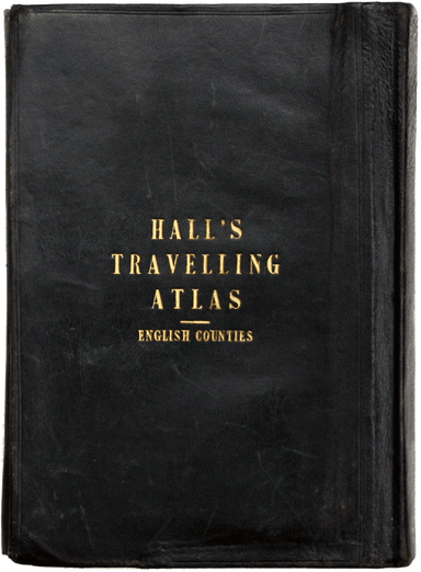
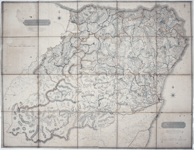
Hall’s Travelling County Atlas – First Edition
A Travelling County Atlas: With all the Coach and Rail Roads accurately laid down and coloured and carefully corrected to the present time. London:...
View full detailsA Travelling County Atlas: With all the Coach and Rail Roads accurately laid down and coloured and carefully corrected to the present time. London:...
View full detailsOur example of the map has been annotated in ink to show the early expansion of the railway system, with railways completed and under construction....
View full detailsIf thou art worn and hard beset with sorrows that thou wouldst forget… Go to the woods and hills; no tears dim the sweet look that nature wears. He...
View full detailsThis pictorial map of London employs an unusual form of Turkish fold which makes use of inclined folding lines. The map is a simplified pocket vers...
View full detailsMacDonald Gill, brother of Eric, was a successful commercial artist in his own right, and a noted calligrapher who designed the font used on all he...
View full detailsThis iteration of the UERL common design marks George Philip & Son’s first official map for the Underground Group; the firm had designed the fi...
View full detailsThe earliest versions of this map advertised the Franco-British Exhibition which closed at the end of October 1908, marked here as ‘Exhibition’. In...
View full detailsOur map shows bus, tram and train services operated by the Underground Group and is very similar to the pocket map issued in guidebooks c. 1924. T...
View full detailsThe London General Omnibus Company was by this point owned by the Underground Group and this is an early attempt at transport integration, with the...
View full detailsCondition & Materials Lithographed in red and black on two sheets, each 38.5 x 80 cm; this map of Long Island is printed on thin india paper; ...
View full detailsMogg’s New Map of the Roads. A New Travelling Map of England, Wales and Scotland […] Condition & Materials Copper engraving, 77 x 63.5 cm, a ro...
View full detailsThe first edition of this map was printed in 1932 but the introduction of Beck's diagram in 1933 did not obviate the need for geographically accura...
View full detailsLoosely inserted into this railway guide is a 1952 letter from Bradshaw’s, replying to an enquiry from Gordon C. Dickinson, a former owner of our c...
View full detailsThis issue of the London Underground map, the last of Beck’s pre-war card folders, features on its reverse an enlargement of the central area with ...
View full detailsThis was the first official London Underground passenger map to be printed since spring 1943, at least partly due to paper shortages. When printed ...
View full detailsUnderground Railways of London What to see and how to travel: Map of the Electric Railways of London Condition & Materials Summer 1925 issue of...
View full detailsThe Central London Railway produced a considerable quantity of advertising material in the Edwardian period. Other postcards included views of Lots...
View full detailsMetropolitan Goods Conference Map of Collection & Delivery Boundary This map is a variant of the London plan typically issued with Kelly’s Dire...
View full detailsDistrict within ¼ mile radius [of] Manor House Stanford’s was a firm of map publishers as well as map retailers until after the Second World War, w...
View full detailsGarbutt believed he had ‘rescued’ the London Underground map from the clutches of Harold Hutchison and his ‘ham-fisted parody’ of Beck’s designs. H...
View full detailsPrinted in December 1964, this is an early iteration of Garbutt’s design, which had been unveiled to the public in May. Garbutt believed he had ‘re...
View full detailsThis is an LNER colliery map covering the midlands and north of England and Wales ('Collieries in Yorkshire, Nottinghamshire, Derbyshire, Lancashir...
View full detailsDistrict within ¼ mile radius [of] Uxbridge Stanford’s was a firm of map publishers as well as map retailers until after the Second World War, with...
View full detailsThe guide seems to have been aimed at an American audience, with several pages devoted to converting prices in pounds, shillings and pence into dol...
View full detailsThis Central London Railway map is similar in style to the UERL common design which had been in circulation since 1908, although with a chocolate r...
View full detailsBenjamin Getzel Lewis' map of the London underground shows the Victoria Line under construction in the originally proposed colour Lewis (1900-1966)...
View full detailsNachtverkehr der BVG… Winter 1934/35 Published by the Berlin Transport Corporation, the BVG, this unusual passenger map and timetable details the n...
View full detailsPublished in March 1935, this is a commercially available map showing the operating area of the recently formed London Passenger Transport Board, a...
View full detailsBeck’s diagram is possibly one of the most innovative and influential designs of the twentieth century. First published in 1933, Beck remained dire...
View full detailsDistrict within ¼ mile radius [of] Paddington Praed Street Stanford’s was a firm of map publishers as well as map retailers until after the Second ...
View full detailsGarbutt believed he had ‘rescued’ the London Underground map from the clutches of Harold Hutchison and his ‘ham-fisted parody’ of Beck’s designs. H...
View full detailsThe introduction of Beck's diagram did not obviate the need for geographically accurate maps, which pinpointed the location of Underground stations...
View full detailsCheffins’s Map of the English & Scotch Railways Cheffins’s Map of the Railways in England & Scotland, accurately delineating all the lines ...
View full detailsThis map attempts full integration of bus and coach routes, tramways, the Underground and main-line railways, and is possibly the first issue showi...
View full detailsIn 1933 the Met became part of the LPTB. Here though, the Tube and other railways fade into the background. The emphasis is on work/life balance, c...
View full details