£300.00
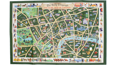
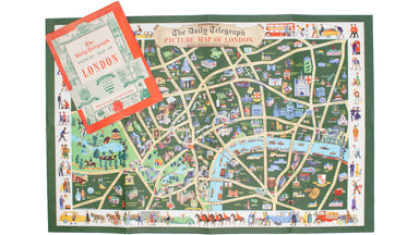
Daily Telegraph Picture Map of London
This pictorial map depicts various London ‘types’ in the borders, and shows the Royal Festival Hall (built for the 1951 Festival of Britain) and th...
View full detailsThis pictorial map depicts various London ‘types’ in the borders, and shows the Royal Festival Hall (built for the 1951 Festival of Britain) and th...
View full detailsRiver Thames Wharf Chart, Sheet 3, showing tiers, moorings, etc. between Barking Creek & Hole Haven. Condition & Materials Folding map, 75...
View full details