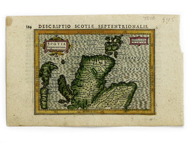
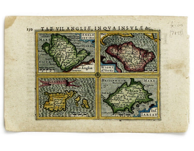
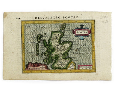
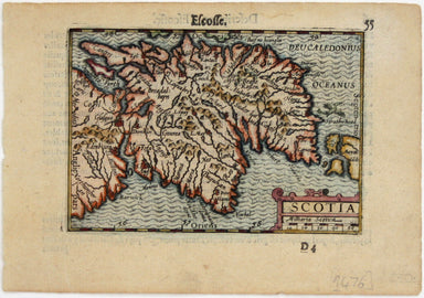
Bertius’ Miniature Map of Scotland, Early Edition
This tiny map of Scotland was engraved by Pieter van den Keere for the Caert-thresoor published by Cornelis Claesz and Barent Langenes in 1598. Deg...
View full detailsThis tiny map of Scotland was engraved by Pieter van den Keere for the Caert-thresoor published by Cornelis Claesz and Barent Langenes in 1598. Deg...
View full detailsNorthumbria, Cumberlandia et Dunelmensis Episcopatus This map of northern England is from the first edition of Tabularum geographicarum contractaru...
View full detailsThis map of Northern Scotland is from the first edition of Tabularum geographicarum contractarum libri, a geographical work which is normally catal...
View full detailsThis map of Udrone from is the first edition of Tabularum geographicarum contractarum libri, a geographical work which is normally catalogued under...
View full detailsAnglesey Insula; Wight olim Vectis; Insula Garnsey; Insula Iarsay This map of Anglesey, the Isle of Wight, Guernsey and Jersey is from the first ed...
View full detailsThis miniature map of Scotland is from the first edition of Tabularum geographicarum contractarum libri, a geographical work which is normally cata...
View full detailsThis map of the British Isles with west at the top was published in the French text edition of Tabularum geographicarum contractarum libri, a geogr...
View full details