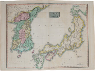
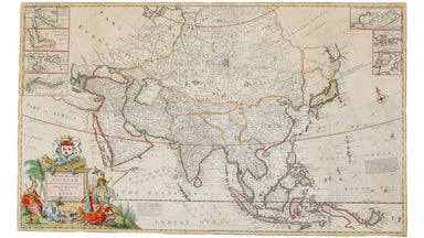
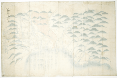
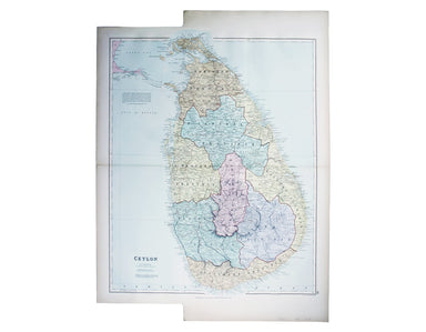
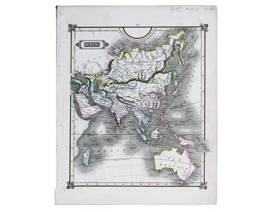
Thomson's Map of Korea & Japan
John Thomson's map of Korea and Japan was engraved by John and George Menzies in 1814 and published in his ‘New General Atlas’ in 1815. Walter sugg...
View full detailsJohn Thomson's map of Korea and Japan was engraved by John and George Menzies in 1814 and published in his ‘New General Atlas’ in 1815. Walter sugg...
View full detailsMoll's map of Asia is dedicated to William Cowper (1665-1723), the first to hold the office of Lord Chancellor (and from 1718 the first Earl Cowper...
View full detailsPresqu’Isle des Indes Orientales, comprenant l’Indostan ou Empire du Mogol, differens Royaumes ou Etats, les vastes possessions des Anglais, et les...
View full detailsThibet, Mongolia, and Mandchouria This map was engraved by John Rapkin for the ‘Illustrated Atlas’; with vignettes including Leh in Ladakh, a stret...
View full detailsLes Indes Orientales This is Santini’s edition of Robert de Vaugondy’s map of the Indian subcontinent and mainland southeast Asia. Venetian map-mak...
View full detailsThis map of the continent of Asia was prepared for the Homann firm by Johann Matthias Hase, professor of mathematics in Wittemberg, on his stereogr...
View full details[Map of] Afghanistan, political, phisical [sic], roads and distances, important historical sites According to the online resource Encyclopaedia Ira...
View full detailsThis map of Persia, Afghanistan and Balochistan is part of the Authentic Imperial Maps series published by the London Geographical Institute. Condi...
View full detailsThis map of Tasmania was engraved by John Rapkin for the ‘Illustrated Atlas'. John Rogers engraved the black and white vignettes including Hobart T...
View full detailsThis map of Asia was published in ‘Oddy’s New General Atlas of the World’. New South Wales appears here on the west coast of ‘New Holland’. James W...
View full detailsSinus Gangeticus; vulgo Golfo de Bengale nova descriptio This is a map of the Bay of Bengal with north oriented to the right. Petrus Schenk and Ger...
View full detailsThis map covers the southern part of the subcontinent (Mumbai is near the upper border), and includes the northern part of Sri Lanka. Pink denotes ...
View full detailsThe focus of this map is Toyama, a significant sea-port in what was once Etchu province on Honshu. On stylistic grounds the map appears to date fro...
View full detailsSouth Pacific Ocean – Society Islands – Tahiti and Moorea (Otaheite and Eimeo) This chart was derived from French surveys of 1869 and 1885. The fir...
View full detailsThis map of Australia has a table in the bottom left, showing the European population (supposedly revised to 1846 but with the original figure give...
View full detailsArchipel des Indes Orientales, qui comprend les Isles de la Sonde, Moluques et Philippines, tirées des Cartes du Neptune Oriental This map of Indon...
View full detailsL’Empire de la Chine dressé d’apres les Cartes de l’Atlas Chinois This detailed and relatively accurate map of China, Korea and Taiwan was derived ...
View full detailsMae Nam Wen and Entrance, Surveyed by the Hydrographic Department, Royal Thai Navy, March-May 1944 This is a Thai chart of the Mae Nam Welu estuary...
View full detailsThis map of Sri Lanka was published in the first trade edition of Stanford’s ‘London Atlas’. Edward Stanford (senior) acquired Arrowmsith's stock i...
View full detailsThis map of Asia is from ‘A Modern and Ancient General Atlas, comprehending all the Empires, Kingdoms, States in the World’. William Home Lizars tr...
View full detailsThis chart of the Pacific Ocean features two regions named New South Wales. Cook’s New South Wales in Australia remains familiar, but the other, on...
View full detailsThis map of New Zealand was published in the second trade edition of Stanford’s London Atlas. Edward Stanford (senior) acquired Arrowmsith's stock ...
View full detailsThis map of Burma was published in the second trade edition of Stanford’s London Atlas. Edward Stanford (senior) acquired Arrowmsith's stock in 187...
View full details