He Ain't Heavy, He's My Plaster Relief Map of Sussex...
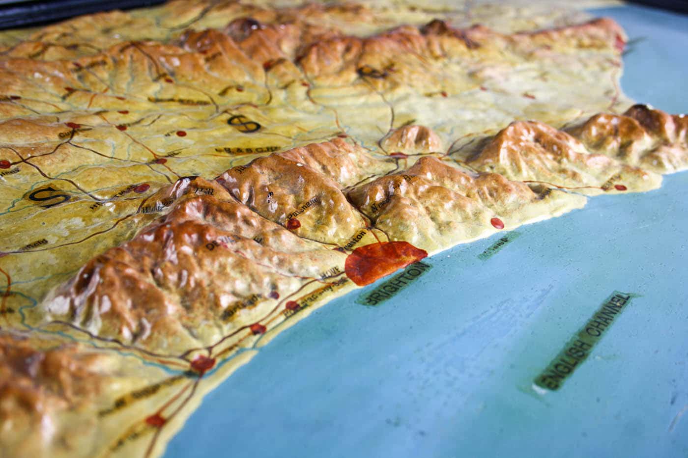
At 8.5 kilos this ‘Relief Model Map of Sussex’ is currently our heaviest as well as one of our scarcest maps. It was published by EJ Arnold & Son Ltd in Leeds, in April 1908.
There are no copies recorded anywhere that we have found as yet. It may have been made for the schoolroom, but we think this Edwardian plaster relief map in its original frame was probably commissioned for display in offices or stations of the London, Brighton & South Coast Railway, whose lines are featured prominently on the map.
EJ Arnold & Son Ltd, of Leeds, were leading educational publishers and wholesale stationers. A series of the firm’s relief maps for use in schools was praised in a 1906 issue of ‘The School World’, which offset the initial costs against perceived durability, the assumption being that a country’s physical features do not change (whereas political boundaries might) so that one model relief map was likely to outlast several conventional wall maps. The maps were by this time made with ‘plaster of Paris mixed with a fibrous matter’ which bound the mass together and also made the maps lighter. The surface was then ‘enamelled in permanent colours’ which was relatively easy to clean.
Arnold’s maps might have been fractionally stronger and lighter than their Victorian predecessors, but very few have survived a century of accidents and house clearances.


Leave a comment